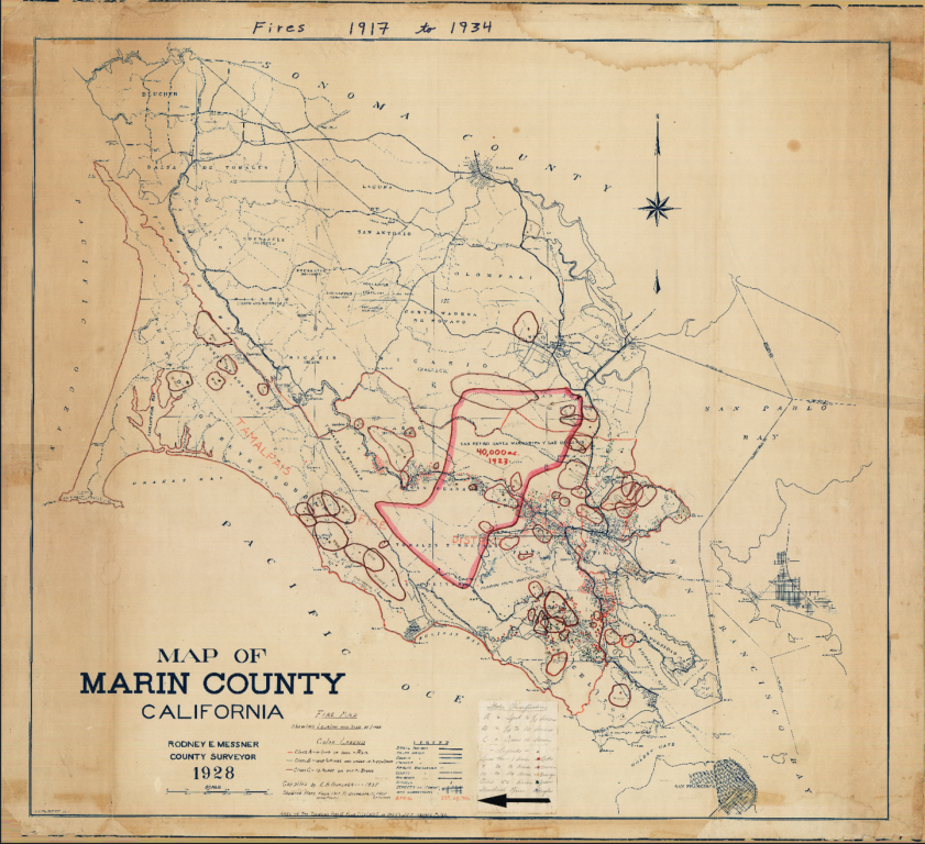

An important piece of Marin history, and valuable data for Marin’s fire and land managers, was recently rediscovered. Several hand drawn maps showing wildfires, dates, and acreages between 1917 and 1941 were compiled by Edwin B. Gardner, Chief Warden of the Tamalpais Forest Fire District and the first Fire Chief of Marin County Fire Department. The Fire Lookout tower atop Mt. Tamalpais was later dedicated and named for Chief Gardner.
Most of the maps have extremely detailed legends, noting dates and acreages, with color coding to denote the size of smaller fires.
The original maps are well preserved, in Marin, and the maps themselves were recently scanned by the National Park Service and National Archives in Washington DC.
The maps and the historic data they contain will become a valuable part of the upcoming Community Wildfire Protection Plan (CWPP) and future planning efforts where historical wildfire data may help land managers understand fire’s role in Marin ecosystems.