 1995 Fire Destroys 45 Homes and Burns 12,000 Acres in West Marin
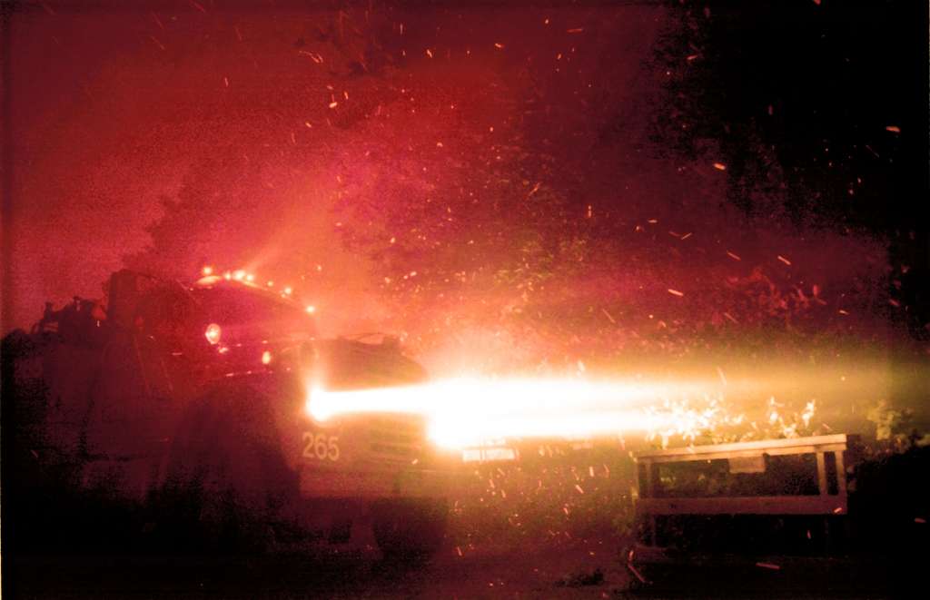
20 years ago today, Marin’s most destructive wildfire in recent memory began on the slopes of Mt Vision near Inverness. Less than four years after the devastating “Tunnel Fire” in the Oakland/Berkeley hills, Marin firefighters and residents saw their own homes and parks blackened by fire in the Wildland/Urban Interface (WUI). Between October 3-16, 1995, the Vision Fire burned 12,354 acres near Mount Vision in the Point Reyes National Seashore, scorching the scenic and sparsely populated land between Tomales Bay and the Drakes Bay along the Pacific Ocean. Winds of up to 45 mph turned the smoldering remains of an illegal campfire on Mount Vision into a firestorm that consumed private property, State Parks, and federal land. Within hours, 45 homes were destoryed in Inverness Park, and the fire forced the evacuation of 422 residents in the hills above Inverness, Olema and Point Reyes Station. There were no fatalities or major injuries.
The Vision Fire added further emphasis to Fire Safe Marin, formed only three years earlier in the aftermath of the Tunnel Fire in the Oakland/Berkeley hills. With new evidence in hand that the concept of Defensible Space had actually saved homes in Inverness, and invigorated Marin communities now truly understanding that such an event could happen in their own backyard, Fire Safe Marin and local fire departments and land agencies began a 20 year program of fuel reduction, education, and community collaboration.
 According to the National Park Service, “The Bear Valley area turned into a self-contained city overnight. Park headquarters became the fire incident command post. Fire engines were parked in the meadow behind the visitor center where Morgan horses usually graze. Tents and sleeping bags dotted the surrounding area.”
“It was highly emotional for us,” National Parks Service spokesman John Dell ‘Osso told the Marin Independent Journal in a story marking the 10th anniversary of the Vision Fire. “We didn’t know when or where it would end.”
Agencies spent $6.2 million to fight the fire, and the damage estimate was set at $23 million. All told, 71 agencies contributed to the suppression and recovery effort.
Vision Fire Timeline:
October 3: An illegal campfire ignites vegetation inforested area near Mt. Vision in Inverness. As the main fire is controlled, a spot fire in a difficult to access location begins to grow. Winds increase to 40-50 mph, creating a fire storm which destroys 45 homes and structures. Hundreds (soon thousands) of firefighters respond from across Marin, the Bay Area, and California.
October 4: Erratic winds increase fire from 1,629 acres to 8,880. Firefighting force grows to 108 engines, 37 crews, 1200 fire fighters. Fire 20% contained by midnight.
October 5: 11,100 acres have now burned. Fire is 60% contained, and 2,000 fire fighters are on scene. Weather changes – higher humidity, lower winds aid suppression efforts. Major push to build fire line from Mt. Wittenberg to beach north of Bear Valley.
October 6: 12,354 acres burned. Fire 60 % contained, with 2,164 fire fighters on scene. A national multi-agency rehabilitation team called in to assess damage to resources.
October 7: Fire is declared 100% contained at 6 p.m.
October 8: Mop-up of smoldering stumps and debris continues, trail rehabilitation begins.
October 9: Mop-up and rehabilitation efforts continue. Fire fighter demobilization expands. Total personnel on scene – 1,680.
October 10: Helicopter and ground crews concentrate efforts on “Hot Spots.”
October 11: Estimated full control midnight. Estimated cost of firefighting efforts $6.2 million. Total personnel remaining on scene – 414.

 1995 Fire Destroys 45 Homes and Burns 12,000 Acres in West Marin


