IN THE EVENT OF AN EMERGENCY THIS SITE IS NOT MONITORED. FOR CURRENT INFORMATION GO TO HTTPS://EMERGENCY.MARINCOUNTY.GOV.
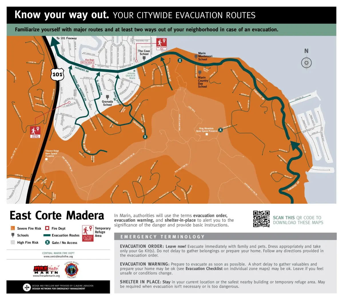
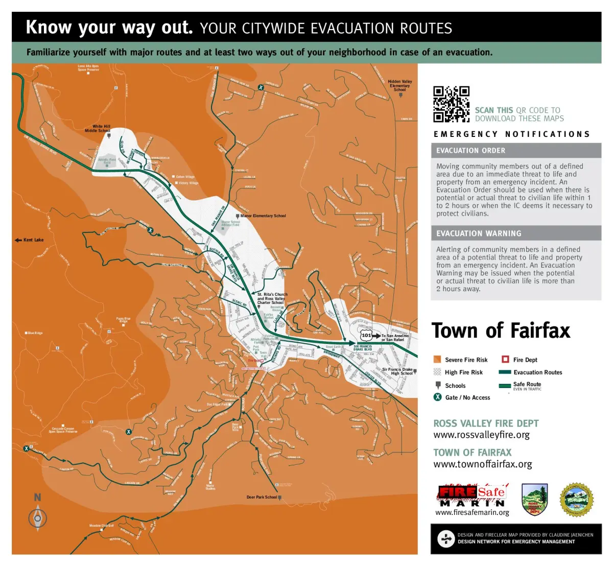
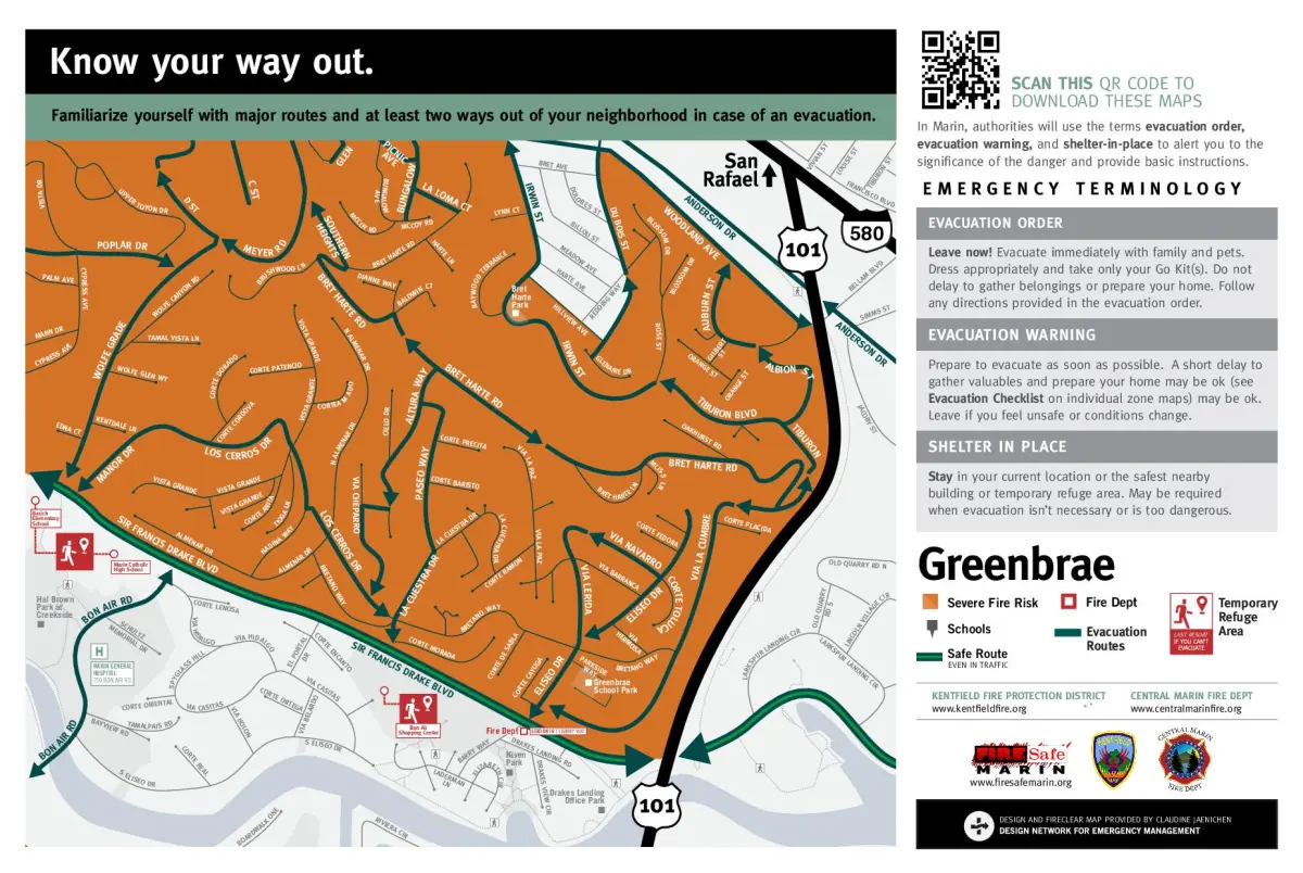
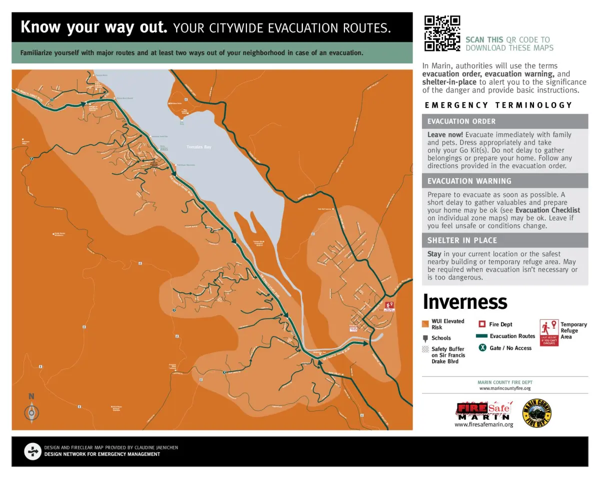
Evacuation Maps
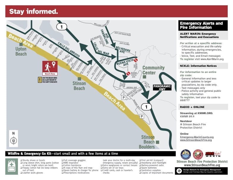
Fire Safe Marin, in collaboration with many Marin fire agencies, cities, towns, and other partners, has developed and published wildfire evacuation maps for several of Marin’s wildland urban interface (WUI) communities. These FireClear maps—funded by local fire agencies, municipalities, and a CAL FIRE grant—are listed by fire department and available online. Additional maps for areas such as San Rafael, Dillon Beach, Bolinas, Marin City, and others are still forthcoming. If you need an evacuation map for a Short Term Rental (STR) application and none is currently available for your location, please contact STR@county.gov for assistance.

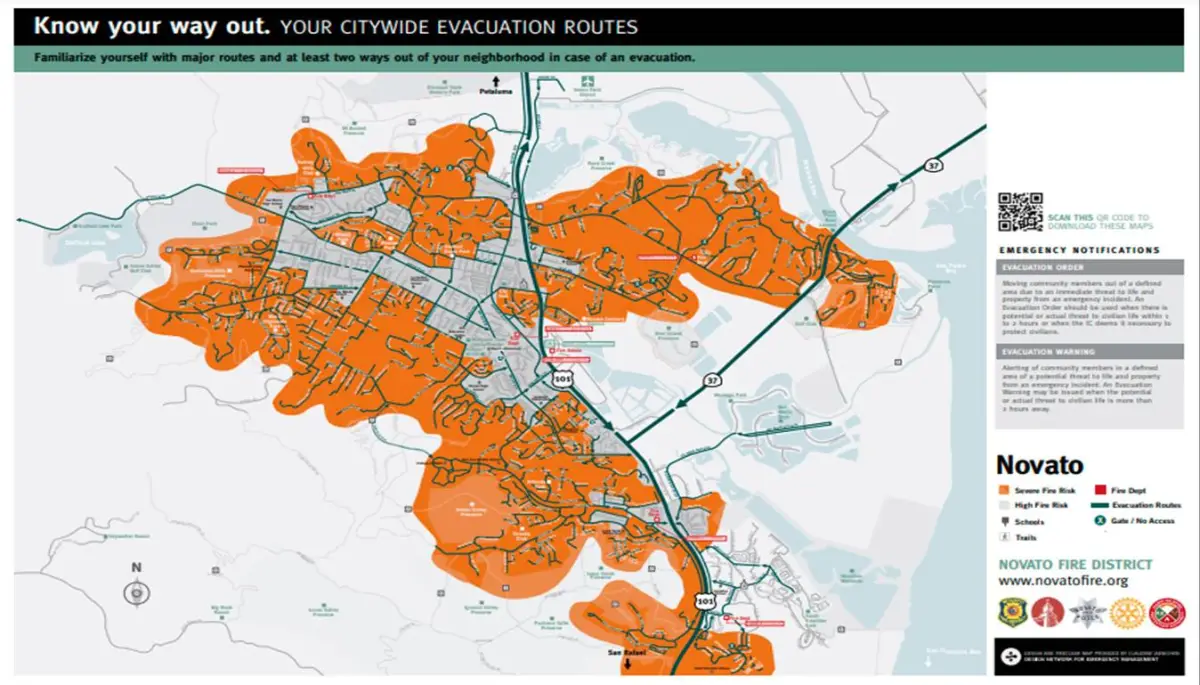
Novato
Zone 8: Bel Marin Keys (Español)
Zone 9: North Hamilton (Español)
Zone 10: South Hamilton (Español)
Zone 11: Marin Valley (Español)
Zone 12: Pacheco Valley (Español)
Zone 13: Alameda de la Loma (Español)
Zone 18: South Novato (Español)
Zone 20: Indian Valley College (Español)
Zone 25: Indian Valley (Español)
Zone 26: Santa Maria (Español)
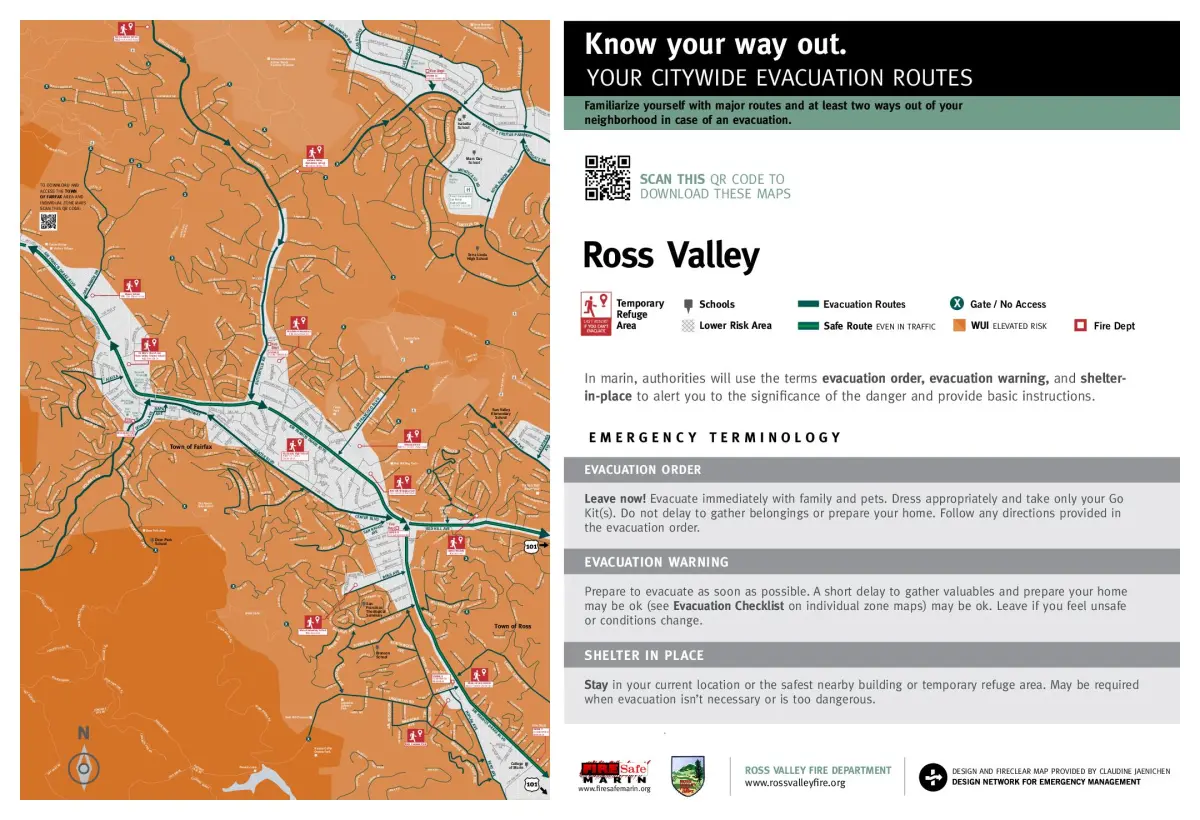
Ross Valley including Ross, San Anselmo & Sleepy Hollow.
Maps often overlap.
Zone 1: Van Winkle (Sleepy Hollow)
Zone 2: Irving (Sleepy Hollow)
Zone 3: Legend Herrera (Sleepy Hollow/San Anselmo)
Zone 6: Alameda (Sleepy Hollow/San Anselmo)
Zone 7: San Francisco Boulevard (San Anselmo)
Zone 10: Redwood (San Anselmo)
Zone 12: Shady (Ross/San Anselmo)
Zone 13: Wellington (Ross/San Anselmo)
San Rafael
Downtown: SNR E510
Picnic Valley: SNR E512
Gerstle Park: SNR E513
Gerstle Park: SNR E514
Sun Valley: SNR E515
West End: SNR E516
Sun Valley: SNR E517
Fairhills: SNR E518
Lincoln / San Rafael Hill: SNR E519
Dominican: SNR E522
Montecito / Happy Valley / Dominican / Black Canyon: SNR E523
Dominican / Black Canyon: SNR E525
West End / Gerstle Park: SAN E015
Bret Harte / California Park: SNR E546
Bret Harte / California Park: SNR E547
Albert Park / Anderson: SNR E511
Canal / Waterfront: SNR E521
Southeast San Rafael / Anderson Shoreline: SNR E541
Spinnaker Point / Bay Point Lagoons: SNR E542
Canal: SNR E543
Southeast San Rafael / Anderson Shoreline: SNR E544
Northgate / Terra Linda: SNR E561
Terra Linda: SNR E562
West Terra Linda: SNR E563
North Terra Linda: SNR E564
Terra Linda: SNR E565
Mont Marin: SNR E566
Los Gamos: SNR E567
Civic Center / Santa Venetia: SNR E571
Santa Venetia: SNR E572
Santa Venetia: SNR E573
Santa Venetia: SNR E574
Civic Center: SNR E575
Merrydale / Corrillo: SNR E576
Los Ranchitos: SNR E577
North San Rafael Commercial Center: SNR E578
Smith Ranch: SNR E580
Smith Ranch: SNR E581
Smith Ranch: SNR E582
Smith Ranch / Deer Valley: SNR E583
Lucas Valley-Marinwood: MRN E581
Lucas Valley-Marinwood: MRN E582
Lucas Valley-Marinwood: MRN E583
Lucas Valley-Marinwood: MRN E584
Lucas Valley-Marinwood: MRN E5845
Lucas Valley-Marinwood: MRN E586
Lucas Valley-Marinwood: MRN E587
Lucas Valley-Marinwood / Terra Linda: MRN E588
Deer Valley: MRN E589
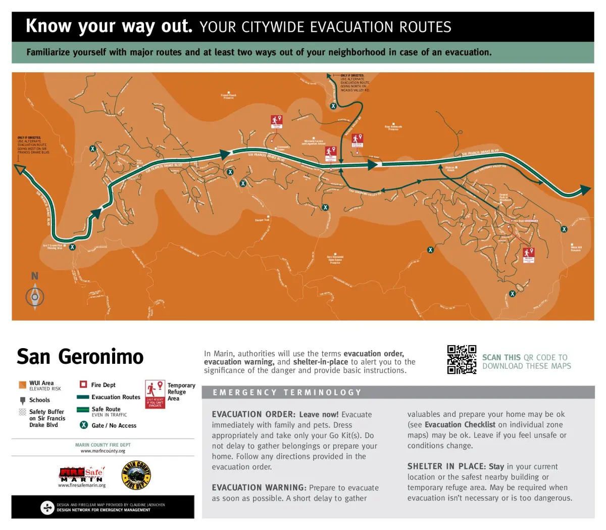
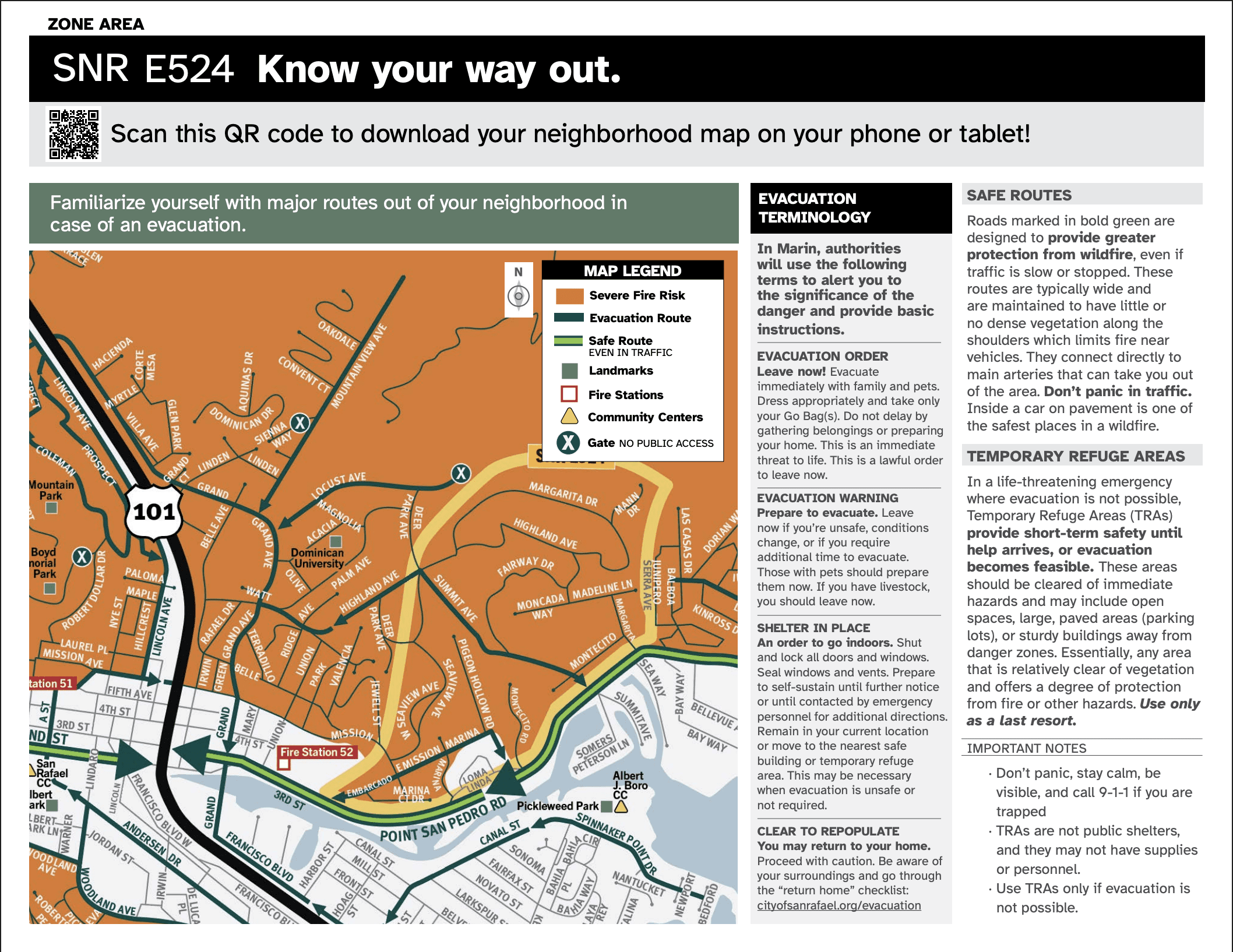
Country Club: SNR E524
Loch Lomond / Canal North Shore: SNR E551
Loch Lomond / Canal North Shore: SNR E552
Bayside Acres / Glenwood: SNR E553
Peacock Gap: SNR E554
Rock Quarry: SNR E555
China Camp / McNear’s Beach: SNR E556
China Camp / Glenwood: SNR E557
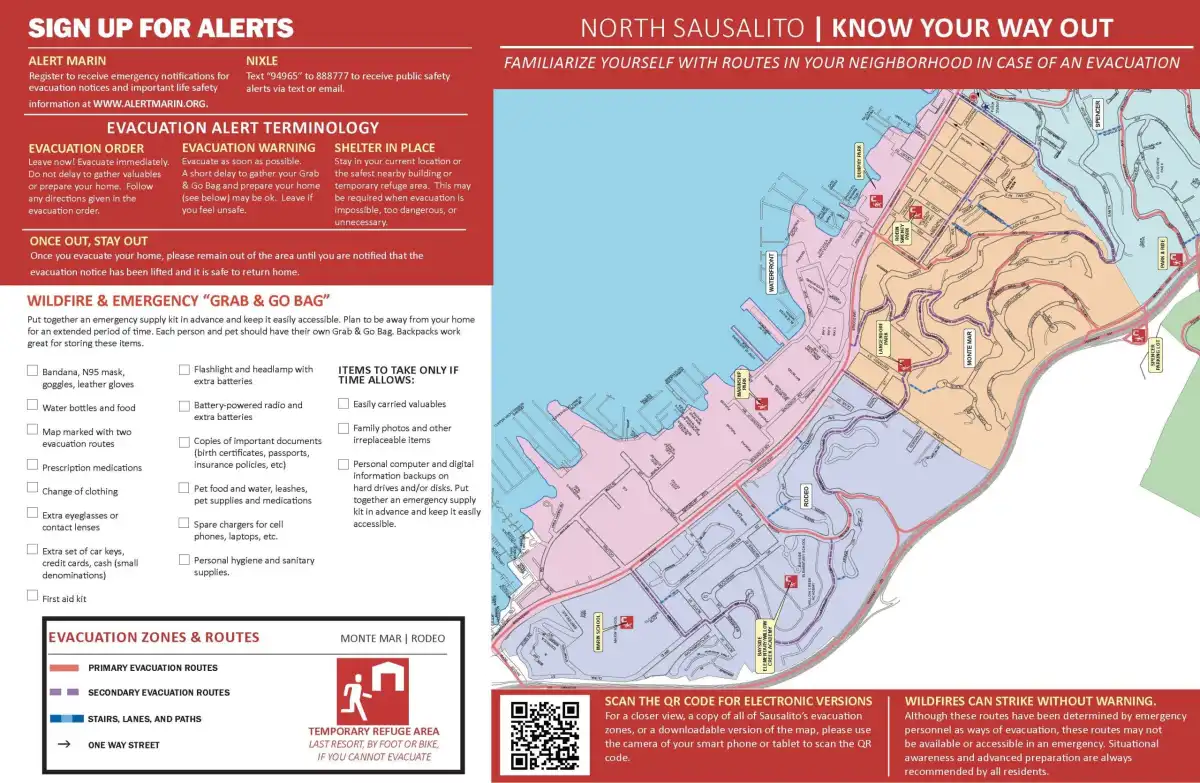
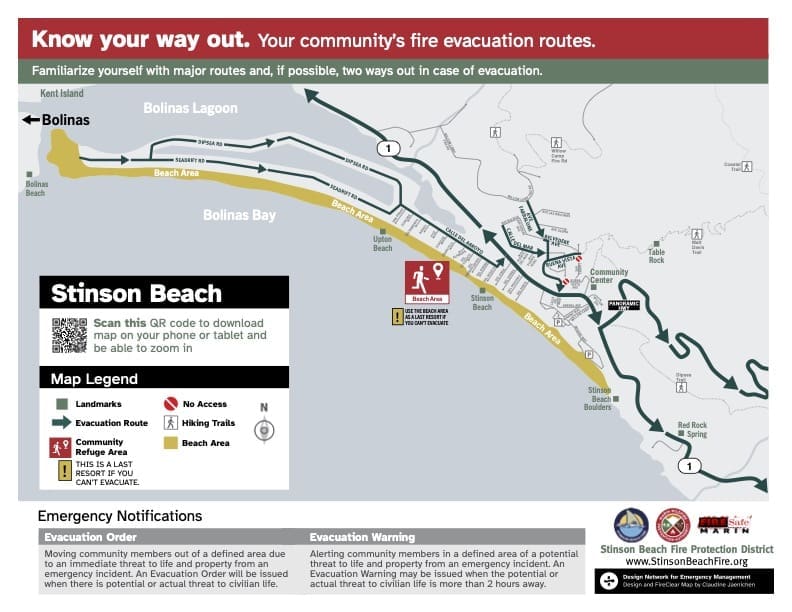
Southern Marin
Mill Valley – Cascade Summit Upper West Edgewood
Mill Valley – Lower Edgewood – Upper Mill Valley Flatts
Mill Valley – Lower Mill Valley Flatts Bayfront Park Seaver
Mill Valley – Upper – Lower Blithedale – Upper Hillside – Lower Bolsa
Mill Valley – Upper Lower Scott Valley – Lower Hillside Alto Sutton
Southern Marin- Homestead Valley – East Tam Valley Hawk Hill North Greenhill
Southern Marin- Homestead Valley – West Four Corners
Southern Marin – Tam Valley – Erica Chamberlain Nothern Marin Drivey
Southern Marin – Tam Valley -Marin View North – So. Tennessee
Southern Marin- Tam Valley – Hawk Hill Central South Poplar Manzanita


