IN THE EVENT OF AN EMERGENCY THIS SITE IS NOT MONITORED. FOR CURRENT INFORMATION GO TO HTTPS://EMERGENCY.MARINCOUNTY.GOV.
that the map does not accurately represent the current WUI boundaries for Tiburon, which can be viewed here.
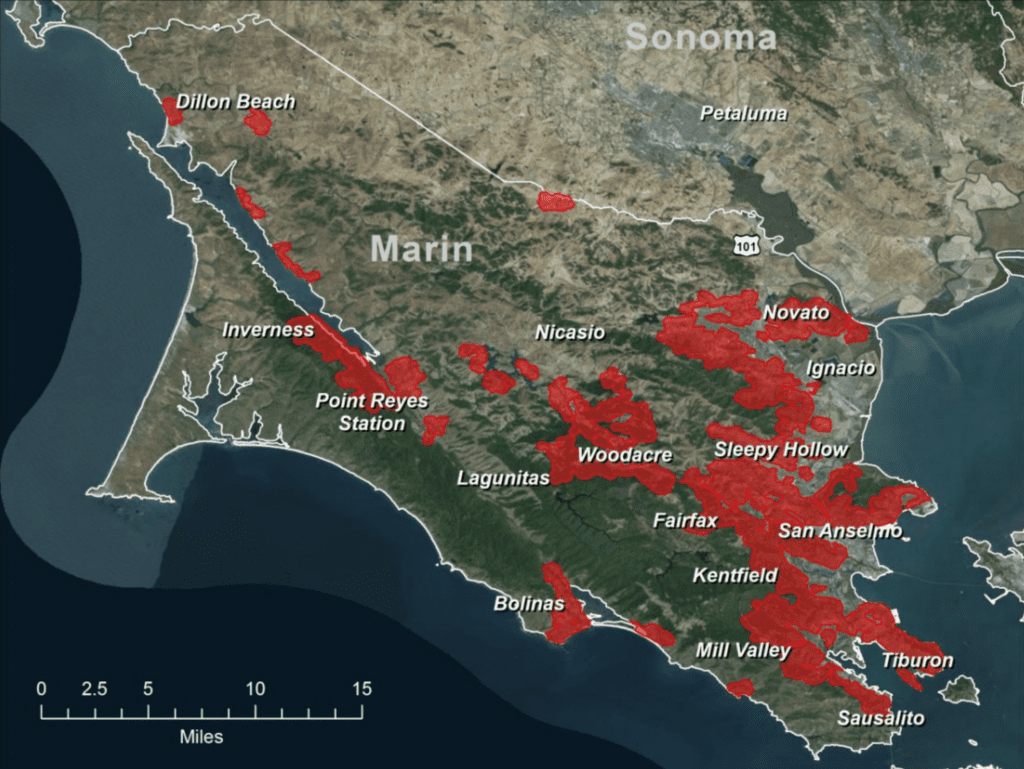
The term Wildland Urban Interface (WUI) is not a designation of potential wildfire severity, but rather a somewhat loosely defined description of an area where urban development meets undeveloped lands at risk of wildfires. The federal definition of WUI excludes areas where development falls below a certain threshold, so a single house far from other structures may not be considered to be in the WUI even though it is in the middle of a wild area. Conversely, areas with dense development may not be WUI because of the housing density, even though they may be close to wildlands.
Marin County is located in the North San Francisco Bay Area in California. The county is approximately 520 square miles (332,800 acres) with a population of approximately 259,000 and is largely rural. The county is bordered by Sonoma County to the northeast, the East San Francisco Bay Area to the southeast, and San Francisco County to the south, with the Pacific Ocean along its western border. Most of the county’s population resides in the eastern, urban-developed region of the county along the Highway 101 corridor. The west region of the county—in and around Pt. Reyes—is a popular local tourist region covered by parklands and recreation areas. The northwest is sparsely populated, agricultural rangeland. Approximately 60,000 acres—18% of the county’s land area—falls within the wildland urban interface (WUI) where residences (i.e., homes and structures) are intermixed with open space and wildland vegetation.