In response to growing fire risk in the wildland-urban interface (WUI) and the enactment of the Healthy Forests Restoration Act in 2003, communities are increasingly using Community Wildfire Protection Plans (CWPPs) to help mitigate the risks posed by wildfire events. The distribution of fuels surrounding and across a community is a critical piece of information for CWPP development.
Using up-to-date, high-resolution fuel maps, communities are able to assess fuels and model potential fire behavior should a wildfire event occur. Such modeling exercises can be used to help prioritize fuel reduction efforts; however, accurate results rely on representative information about the type of fuels available to burn, fuel moisture, and weather.
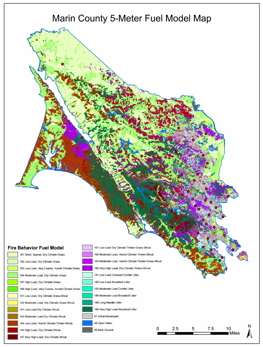
As part of the effort to update the CWPP for Marin County, we compiled 5-meter-resolution and 30-meter-resolution fire behavior fuel model maps to provide an updated, high-resolution data layer of current fuel conditions that is more accurate than the standard LANDFIRE fuel map (30-m). The maps were derived from available LiDAR and aerial imagery as well as datasets reflecting vegetation types and the presence of structures, roads, and water bodies. These maps are critical tools for Marin County fire hazard mitigation planning; they were used to conduct analyses of fire risk and fire hazard reduction projects described in the CWPP.
High-Resolution PDF 5m Fuel Model Map for Marin County, CA
Download the Raw Data in LCP Format for use with FARSITE or FLAMMAP (2GB)