Delivering the Greatest Impact
As part of the ongoing Community Wildfire Protection Plan (CWPP) development, Marin Wildfire and the Project Team completed a countywide analysis of wildfire risk to identify where homes are most exposed and which on-property conditions most commonly increase vulnerability. This information guides inspections, education efforts, and mitigation programs so resources can be focused where they have the greatest impact.

Why This Matters
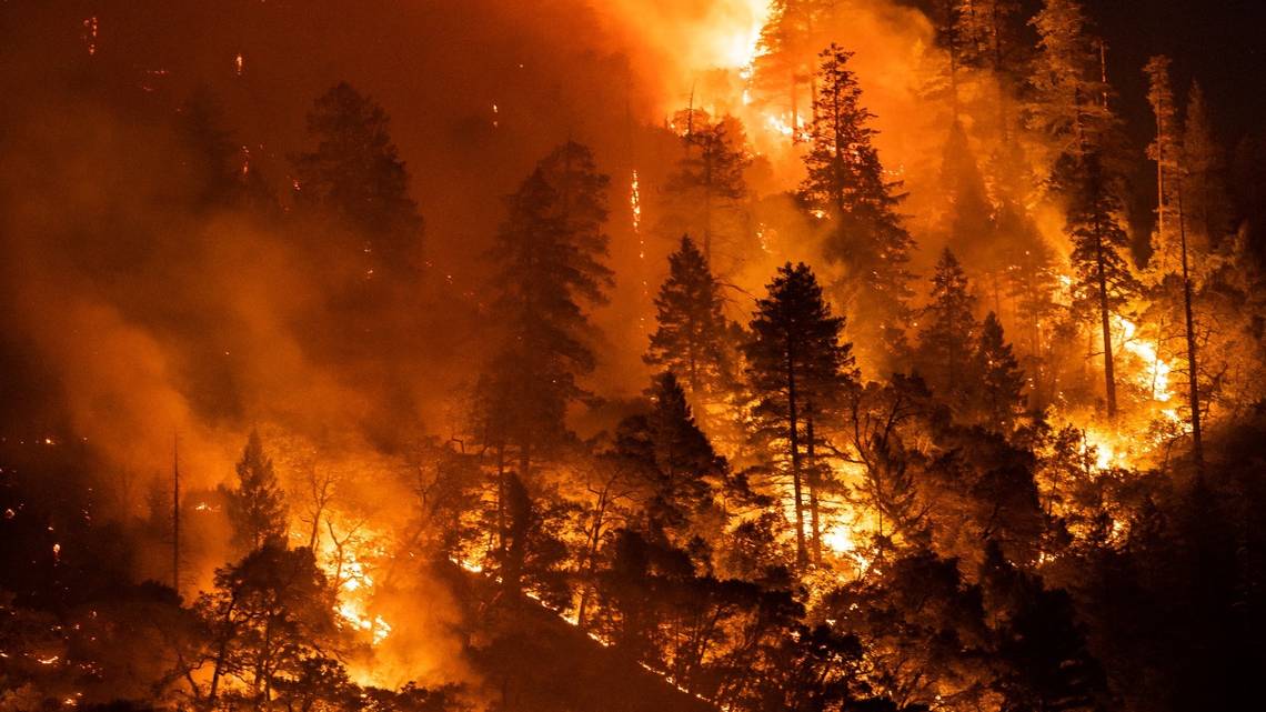
Wildfires can generate high flames, fast-moving fire, and heavy ember showers, which are conditions that can overwhelm fire crews and raise the likelihood of home ignition. Some homes lie directly in the areas where wildfire is most likely to enter neighborhoods, making preparedness essential for the safety of all.
Key Findings
Wildfire exposure is widespread
Modeling shows many structures could experience very active fire behavior, including high flame lengths and heavy ember showers. In some cases, fire intensity may exceed what firefighters can safely control, even with air support.
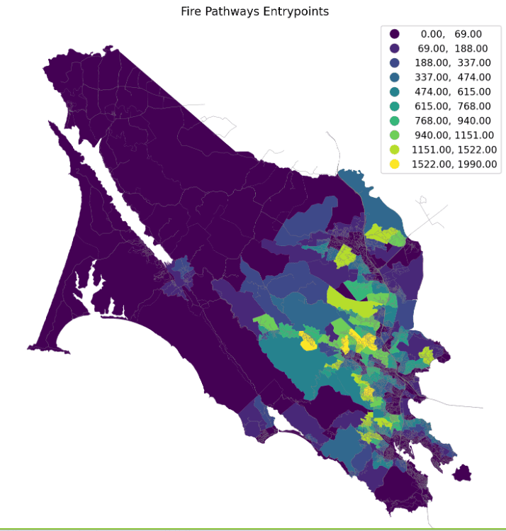
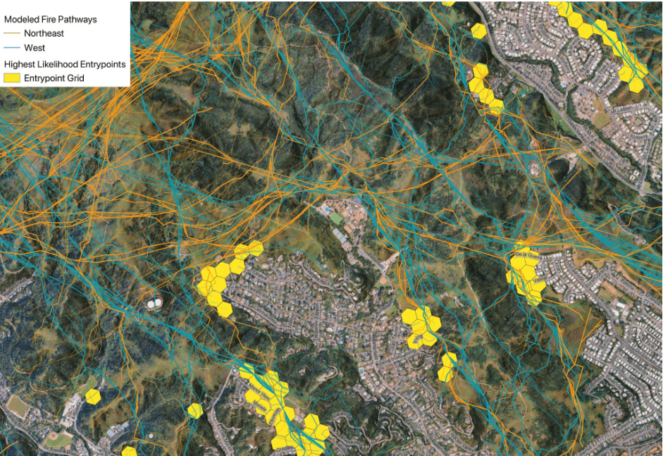
Over one-third of Marin homes are in “fire entry areas”
These are the areas in neighborhoods where wildfire is most likely to reach first. “Fire Pathways” mapping highlights the primary approach routes and helps prioritize extended defensible space and vegetation-management projects with the greatest community benefit.
Common home-level risks
- Vegetation too close to the home (Zone Zero – the area within five feet of the building)
- Debris collecting in gutters
- Wooden fences attached to the house
- Vent screens that do not block embers
Removing vegetation in Zone Zero and modifying combustible fences would create some of the most significant safety gains countywide. Upgrading vent screens is another low-cost, high-impact improvement.
Tightly spaced homes increase spread
In some areas, homes are less than 30 feet apart, which raises the risk of fire spreading from structure to structure during a major event. Neighborhood wildfire preparedness practices are crucial for wildfire safety.
How to Protect Your Home
- Clear your Zone Zero (the area up to five feet from the building)
- Remove plants, wood piles, mulch, and any combustible items next to the home.
- Upgrade vents and gutters
- Install ember-resistant vent screens (low cost and very effective)
- Metal gutters with screens are preferable to non-metal uncovered gutters
- Modify or replace combustible fences
- Wooden fences attached to the house can act like a fuse. Find out about alternatives.
- Keep gutters clear
- Dry debris ignites easily where embers land.
- Know your home’s risk
- Use your home evaluation report to understand your property’s needs and take action promptly.
- Find out more about the home inspection process online.
- Learn how to harden your home and help protect you from disaster.
- Learn about Firewise USA
- Find out if you live in a Firewise neighborhood or how to form one.
We’re Here to Help
Marin Wildfire’s Defensible Space & Home Hardening Program provides free evaluations, personalized online reports, clear recommendations, and follow-up support.
Our team works countywide to help reduce wildfire risk, but community action at the home level remains one of the most critical pieces of protection.
Additional resources:
Funding for Fire Safe Marin’s participation in the CWPP project was provided by a grant from the California Department of Forestry and Fire Protection as part of the California Climate Investments Program, through the California Fire Safe Council.
Funding for the Community Wildfire Protection Plan (CWPP) Update Project comes from Measure C funds through Marin Wildfire.