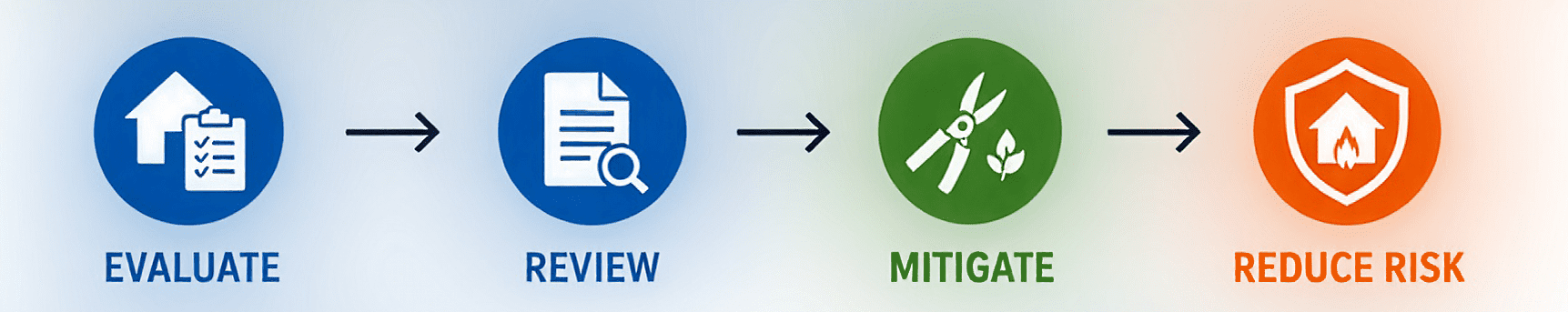
What is the Wildfire Risk Home Evaluation Program?
Supported by Marin Wildfire, the Wildfire Risk Home Evaluation program is implemented annually by local fire agencies. Defensible space inspectors are tasked with conducting evaluations of properties, looking at defensible space, vegetation, and key home-hardening features that can affect how a home performs during a wildfire.
There are 87,324 residential parcels across Marin Wildfire’s five zones (Novato, San Rafael, Central Marin, West Marin and Southern Marin). Each zone’s local agency set their annual target number of evaluations at one-third of all residential parcels in their zone, so that each parcel is evaluated approximately once every three years.
Inspectors assess conditions around the property and identify practical steps residents can take to make their homes more resistant to embers, heat, and flames. The program has been increasingly successful each year, delivering measurable results towards the safety of our county.
The goal is simple: help every resident move from uncertainty to action. And progress is being made!
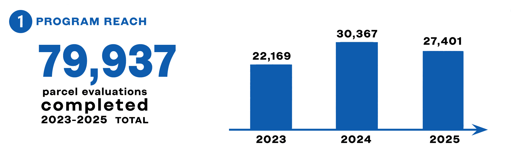
2023 through 2025: Getting Work Done!
During an evaluation, trained inspectors identify defensible space and home-hardening issues that could increase a property’s vulnerability to wildfire. Residents then receive a personalized Wildfire Risk Report outlining the issues found, recommended actions, and resources that can help them complete the work.
From 2023 through 2025, the program completed 79,937 parcel evaluations across Marin. The data also shows that residents are becoming more engaged with their results and taking more action after their evaluations.
The More, the Merrier!
Opening the Wildfire Risk Report is an important next step because it gives residents a clear, personalized guide of prioritized improvements they can make around their homes.
In 2023, about 41% of evaluated households opened their reports (8,993 opens) within 15 days. By 2025, that rate had climbed to 64%, with 17,456 reports opened that year, an increase of 94% from 2023.
This growth suggests that more residents are moving beyond the evaluation itself and using their reports to better understand what needs to be done.

The Mitigation Boom
The strongest increase occurred in the number of defensible space violations confirmed as mitigated. Meaning that residents took action on the prioritized items in their Wildfire Risk Report. Residents can confirm completed work through their online report portal, including the ability to submit photos. Violations may also be marked as resolved during follow-up inspections by the respective local fire agency.
That figure rose from 20,835 in 2023 to 51,836 in 2025, an impressive increase of 149%. These numbers reflect an important shift from identifying wildfire hazards to addressing them.

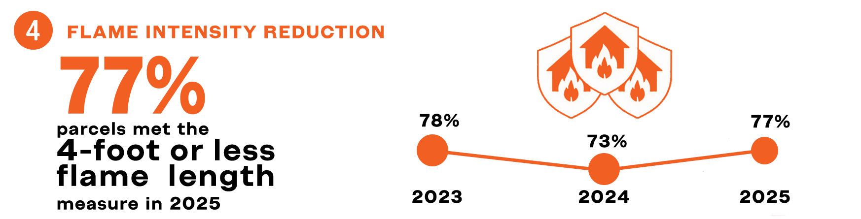
Flame on the Down Low
Marin Wildfire also tracks the percentage of evaluated parcels where the remaining hazards can be valuated to a projected flame length of four feet or less. This measure is one indicator of reduced wildfire intensity around structures, although it does not guarantee that a home will survive a wildfire.
In 2025, 77% of evaluated parcels met that measure. Across the three-year period, the rate remained near three-quarters, indicating that lower projected flame-length conditions were maintained across a large share of evaluated properties.
The Story So Far
The 2023-2025 data shows steady progress across the full evaluation process:
- Thousands of homes are being evaluated each year.
- More residents are opening and using their reports.
- Far more defensible space violations are being mitigated.
- Lower projected flame-length conditions remain widespread.
Together, these trends show growing momentum from evaluation to awareness… and from awareness to action.
Take the Next Step
Your Wildfire Risk Report is designed to help you focus on the improvements that matter most around your home.
Open your report. Review your priorities. Take the next step toward reducing wildfire risk.