IN THE EVENT OF AN EMERGENCY THIS SITE IS NOT MONITORED. FOR CURRENT INFORMATION GO TO HTTPS://EMERGENCY.MARINCOUNTY.GOV.
Evacuation Maps
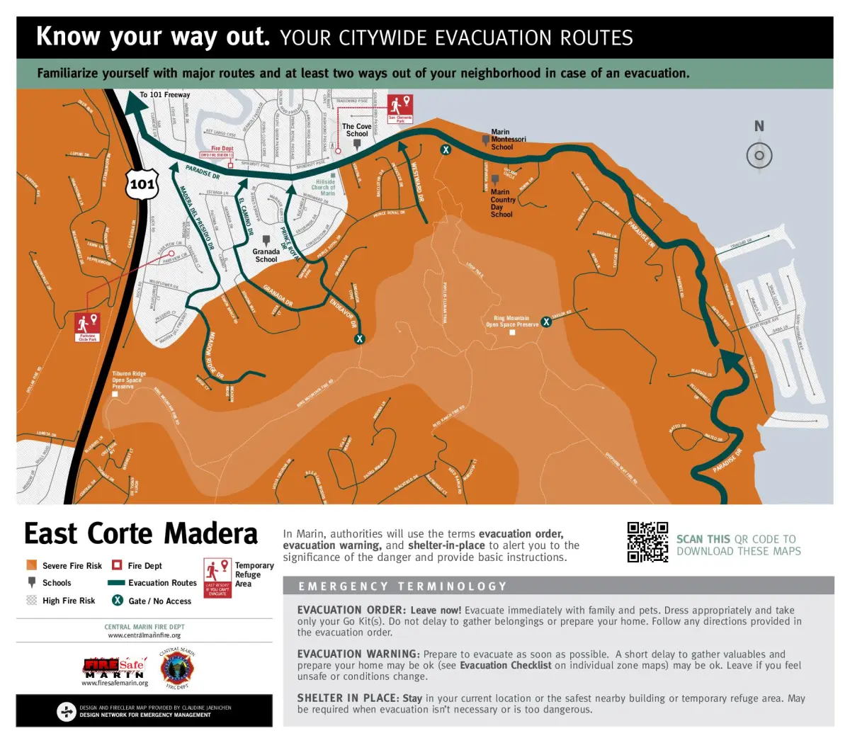
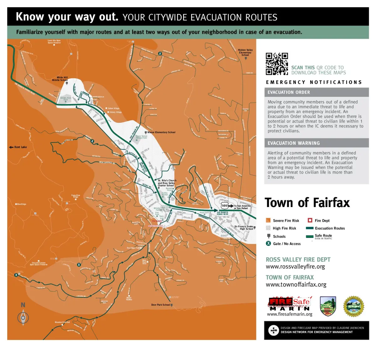
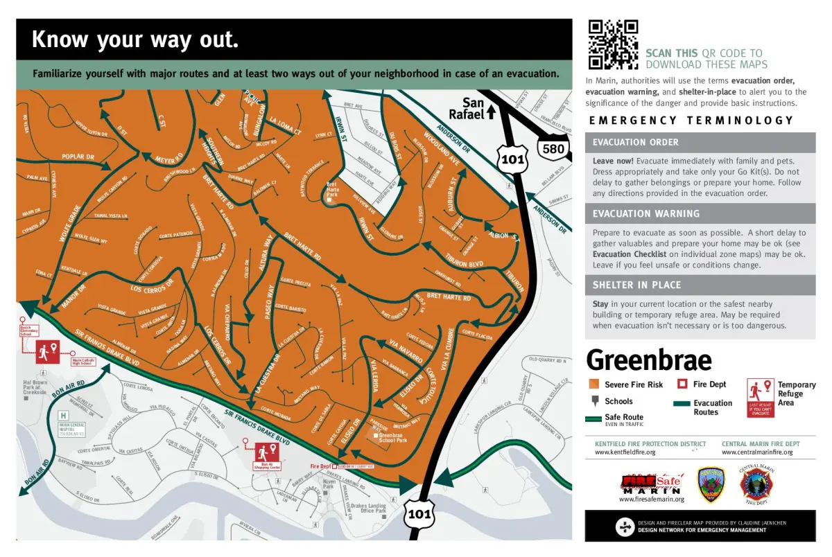
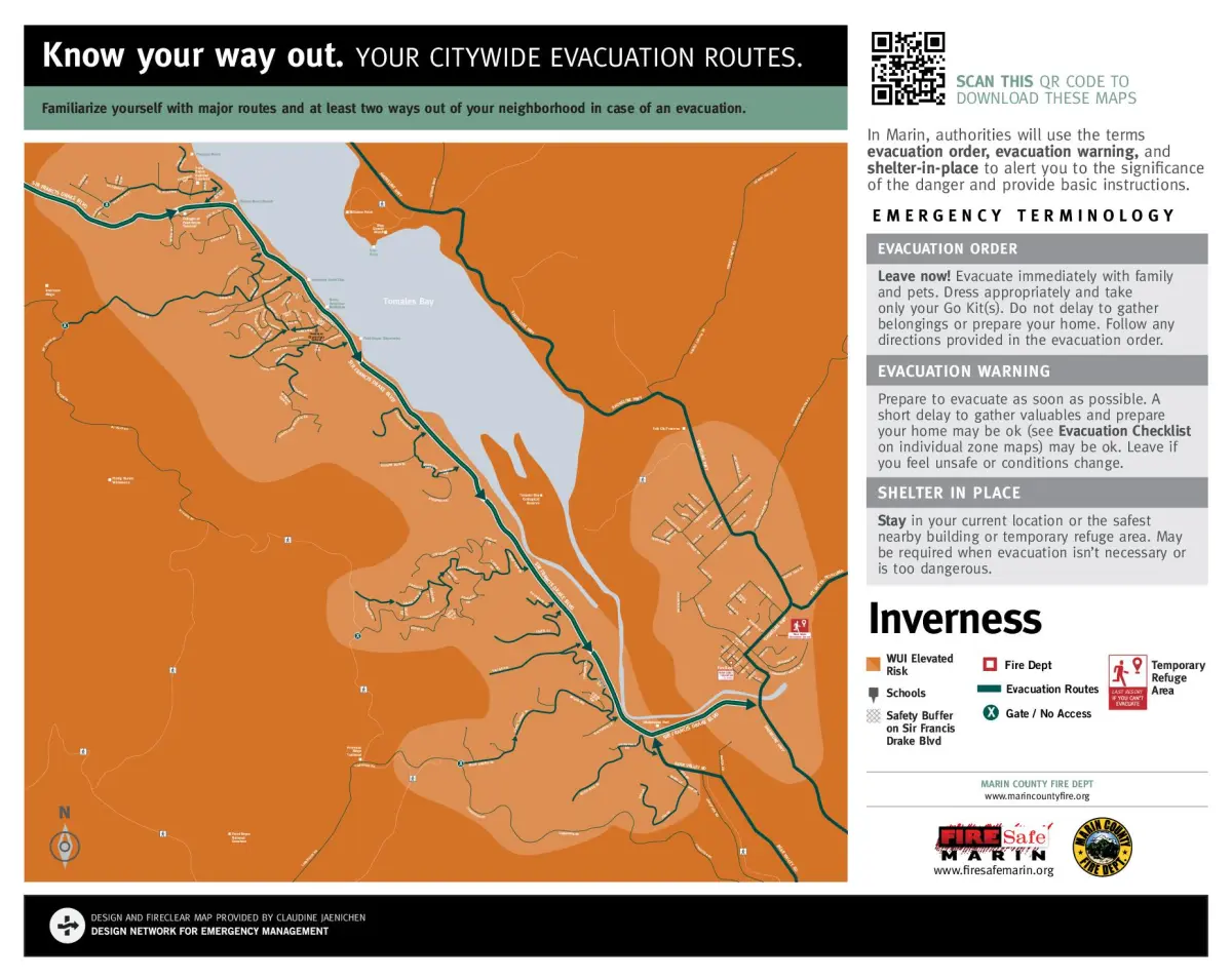
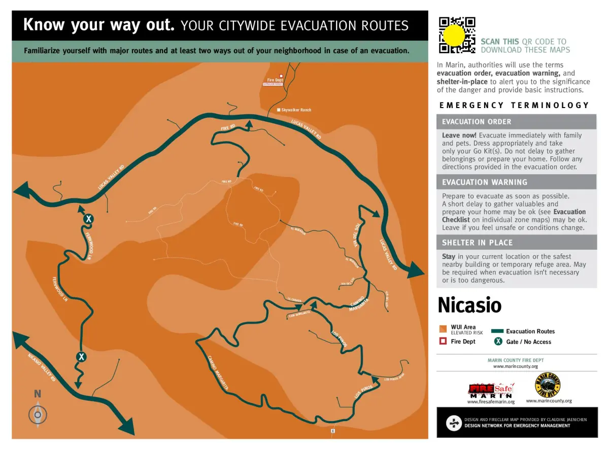
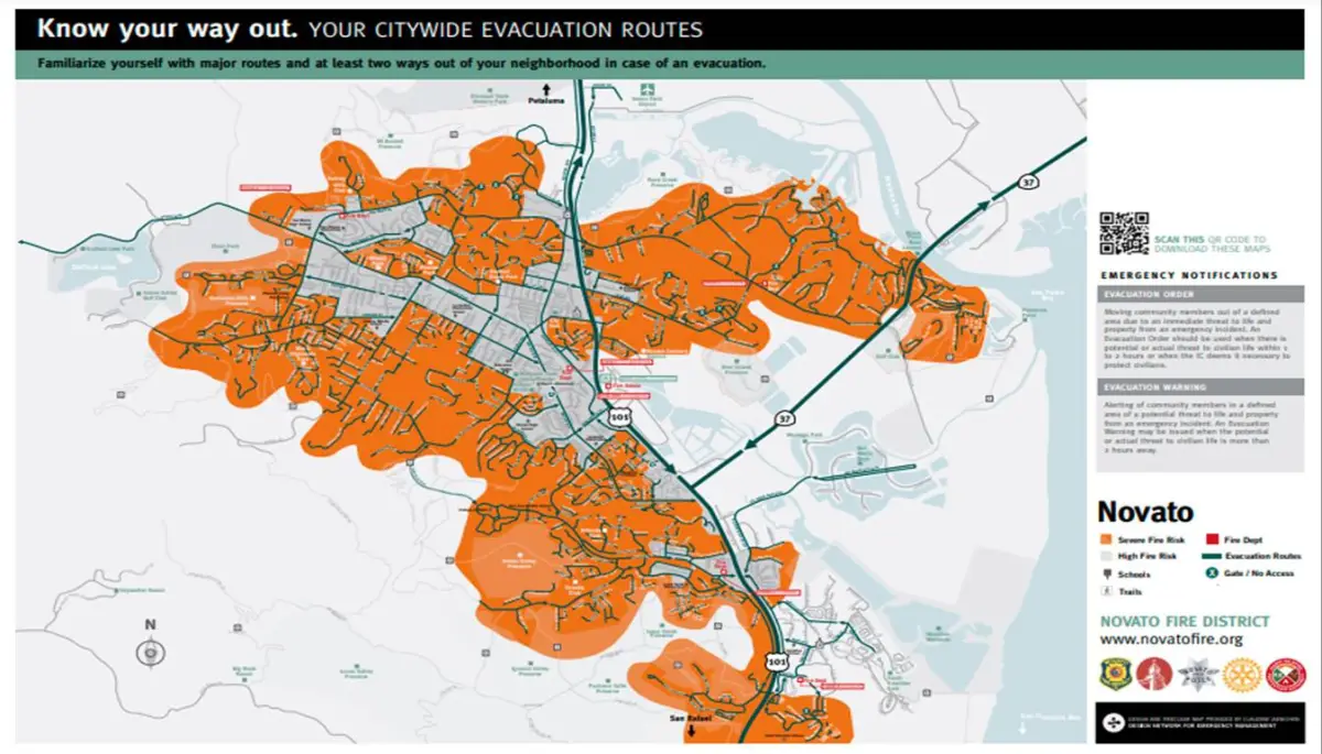
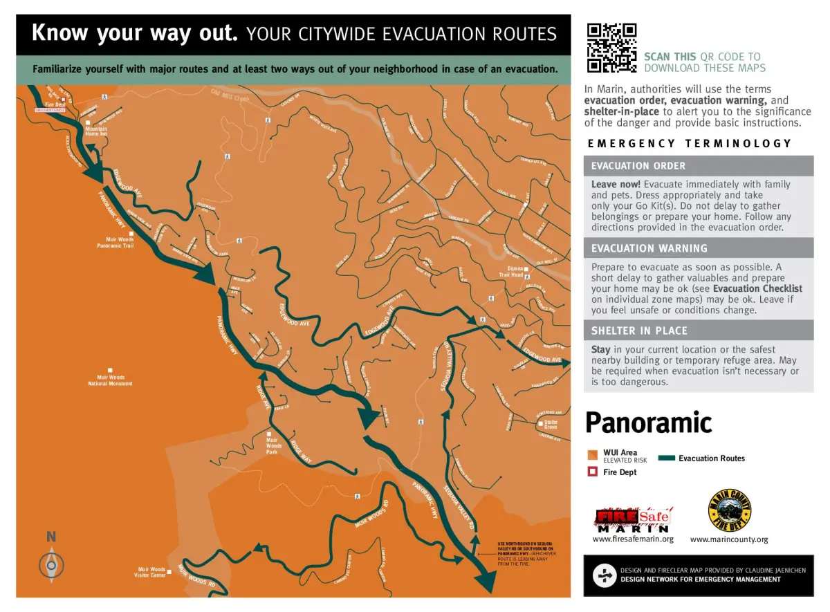
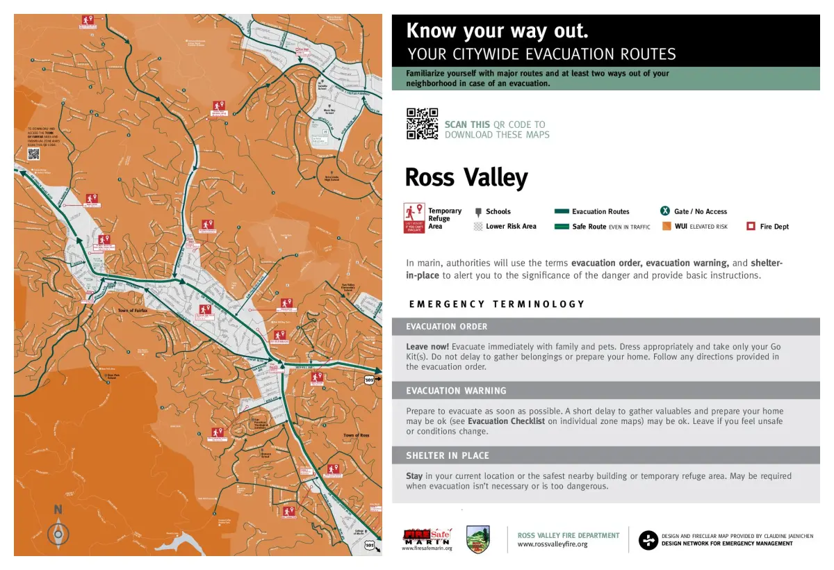
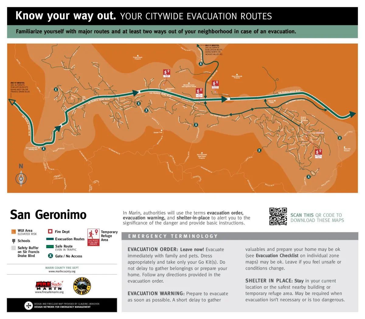
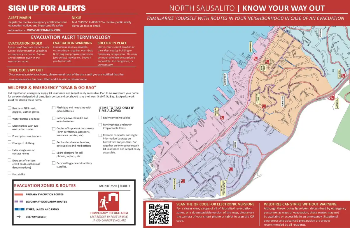
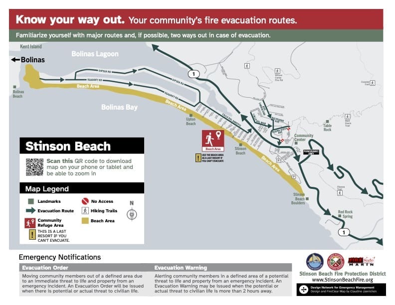
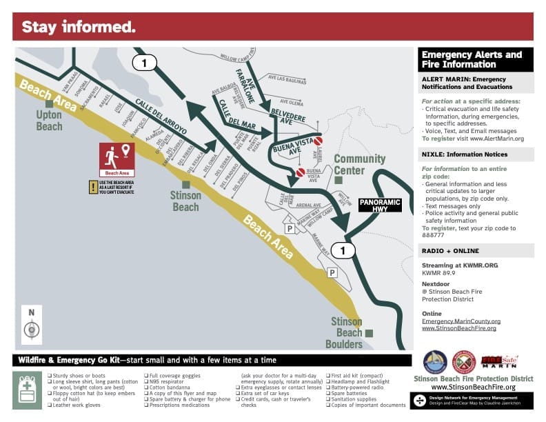
Fire Safe Marin, in collaboration with many Marin fire agencies, cities, towns, and other partners, has developed and published wildfire evacuation maps for several of Marin’s wildland urban interface (WUI) communities. These FireClear maps—funded by local fire agencies, municipalities, and a CAL FIRE grant—are listed by fire department and available online. Additional maps for areas such as San Rafael, Dillon Beach, Bolinas, Marin City, and others are still forthcoming. If you need an evacuation map for a Short Term Rental (STR) application and none is currently available for your location, please contact STR@county.gov for assistance.

Novato
Zone 8: Bel Marin Keys (Español)
Zone 9: North Hamilton (Español)
Zone 10: South Hamilton (Español)
Zone 11: Marin Valley (Español)
Zone 12: Pacheco Valley (Español)
Zone 13: Alameda de la Loma (Español)
Zone 18: South Novato (Español)
Zone 20: Indian Valley College (Español)
Zone 25: Indian Valley (Español)
Zone 26: Santa Maria (Español)
Ross Valley including Ross, San Anselmo & Sleepy Hollow.
Maps often overlap.
Zone 1: Van Winkle (Sleepy Hollow)
Zone 2: Irving (Sleepy Hollow)
Zone 3: Legend Herrera (Sleepy Hollow/San Anselmo)
Zone 6: Alameda (Sleepy Hollow/San Anselmo)
Zone 7: San Francisco Boulevard (San Anselmo)
Zone 10: Redwood (San Anselmo)
Zone 12: Shady (Ross/San Anselmo)
Zone 13: Wellington (Ross/San Anselmo)
Zone 14: Kentfield (Kentfield/Ross)
Southern Marin
Mill Valley – Cascade Summit Upper West Edgewood
Mill Valley – Lower Edgewood – Upper Mill Valley Flatts
Mill Valley – Lower Mill Valley Flatts Bayfront Park Seaver
Mill Valley – Upper – Lower Blithedale – Upper Hillside – Lower Bolsa
Mill Valley – Upper Lower Scott Valley – Lower Hillside Alto Sutton
Southern Marin- Homestead Valley – East Tam Valley Hawk Hill North Greenhill
Southern Marin- Homestead Valley – West Four Corners
Southern Marin – Tam Valley – Erica Chamberlain Nothern Marin Drivey
Southern Marin – Tam Valley -Marin View North – So. Tennessee
Southern Marin- Tam Valley – Hawk Hill Central South Poplar Manzanita


